
TL;DR

Get everyday helpers delivered free with Prime
- Fast, free delivery on millions of items
- Prime Video, Amazon Music and more included
- Member-only deals all year
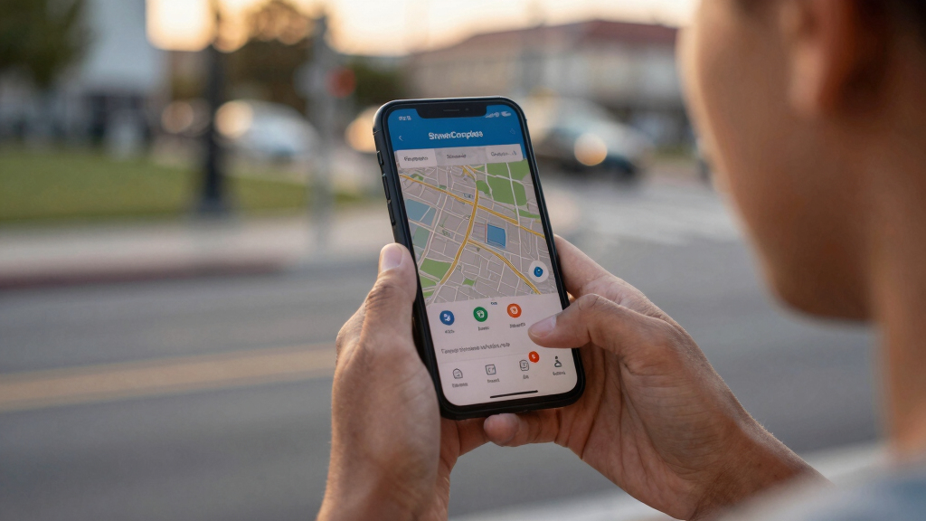
StreetComplete, a mobile app, is making it easier for users to contribute to OpenStreetMap by offering small, guided tasks. This development aims to increase map accuracy and user engagement, with confirmed adoption and ongoing updates.
StreetComplete, a mobile app designed to facilitate small, guided edits to OpenStreetMap, is gaining recognition for lowering the barrier to map contributions. The app allows users to complete simple quests, such as updating street names or adding amenities, which are then reflected in the open-source map. This development is confirmed to be increasing user participation and improving map accuracy, especially in under-mapped areas.
The app, launched in 2018 by developer Michael Reichert, offers a user-friendly interface that prompts users to answer questions about their surroundings. These questions, or ‘quests,’ are designed to be quick and easy, requiring minimal technical knowledge. As of early 2024, StreetComplete has been downloaded over 500,000 times, with a growing number of contributions feeding into OpenStreetMap.
According to the developer, the app’s success is rooted in its simplicity, encouraging casual users to participate without the need for complex editing tools or extensive training. The app integrates with OpenStreetMap’s API, automatically submitting verified edits after user confirmation. The latest version includes new quests for adding bike lanes, updating building details, and reporting map errors, further expanding its utility.
OpenStreetMap, a collaborative project that relies on volunteers to map the world, has historically faced challenges with data accuracy and coverage. StreetComplete aims to address these issues by making contributions more accessible and frequent, especially in regions with limited mapping efforts.
Impact of Simplified Mapping on OpenStreetMap Data Quality
StreetComplete’s approach is significant because it lowers the barrier for casual users to contribute, potentially increasing the volume and quality of data in OpenStreetMap. By focusing on small, manageable tasks, the app encourages ongoing participation, which can lead to more comprehensive and accurate maps. This is particularly important for areas that are underrepresented or outdated, supporting better navigation, urban planning, and humanitarian efforts.
As an affiliate, we earn on qualifying purchases.
OpenStreetMap’s Growth and Challenges in Data Accuracy
OpenStreetMap has grown into one of the world’s largest open-source mapping projects, relying on volunteer contributions worldwide. Despite its success, it faces ongoing challenges related to data consistency and coverage, especially in developing regions. Prior efforts to improve data quality have included dedicated mapping campaigns and community events, but sustained casual participation remains a challenge. StreetComplete’s emergence as a tool for easy contributions aligns with broader efforts to democratize map editing and expand data coverage.
Previous initiatives, such as mapping parties and editing tools like iD, have aimed to increase contributions but often require technical skills or dedicated time. StreetComplete’s focus on tiny, guided quests represents a new approach designed to integrate into daily routines of a wider audience.
“Our goal with StreetComplete is to make mapping as simple as answering questions about your environment, turning casual users into contributors.”
— Michael Reichert
As an affiliate, we earn on qualifying purchases.
Unconfirmed Impact on Long-Term Data Quality
While initial adoption appears promising, it is still unclear how much StreetComplete’s contributions will improve long-term data accuracy and coverage across different regions. The extent to which casual users will sustain engagement over time remains to be seen, and potential issues like data inconsistency or vandalism are still being monitored.
As an affiliate, we earn on qualifying purchases.
Future Developments and Expansion of StreetComplete
Developers plan to introduce new quests focused on accessibility features, public transportation, and environmental data. Additionally, efforts are underway to increase awareness among communities in under-mapped regions. Monitoring user engagement and data quality over the coming months will be key to assessing the app’s overall impact.
As an affiliate, we earn on qualifying purchases.
Key Questions
How does StreetComplete make mapping easier?
It offers simple, guided questions about your environment that you can answer quickly, which are then automatically submitted to OpenStreetMap.
Is StreetComplete suitable for casual users?
Yes, its user-friendly interface is designed specifically for people without technical mapping skills, encouraging broader participation.
Can contributions from StreetComplete be verified?
Yes, the app includes verification steps, and contributions are reviewed before being added to the main map, helping maintain data quality.
Will StreetComplete replace traditional mapping tools?
No, it complements existing tools by providing an easy way for casual users to contribute, especially in areas with limited mapping efforts.
What are the future plans for StreetComplete?
Developers plan to add more quest types, improve integration with community features, and expand outreach to underrepresented regions.
Source: hn
Columbus Day / Indigenous Peoples' Day Picks
long weekend sales
As an affiliate, we earn on qualifying purchases.